File:Hedon Clough and the BP Chemicals site at Saltend - geograph.org.uk - 145508.jpg
No higher resolution available.
Hedon_Clough_and_the_BP_Chemicals_site_at_Saltend_-_geograph.org.uk_-_145508.jpg (640 × 472 pixels, file size: 100 KB, MIME type: image/jpeg)
Summary
| Description |
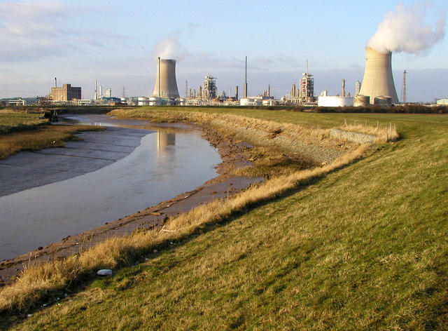
English: Hedon Clough and the BP Chemicals site at Salt End, East Riding of Yorkshire, England. This waterway used to be navigable for nearly two miles up to the town of Hedon. Although nearly two miles inland, Hedon was a port long before Hull nearby was even established! The waterway has been filled in for a lot of its length, but there are ambitious plans to re-open it one day. |
| Date | |
| Source | From geograph.org.uk |
| Author | Andy Beecroft |
| Permission (Reusing this file) |
Creative Commons Attribution Share-alike license 2.0 |
| Attribution (required by the license) | Andy Beecroft / Hedon Clough and the BP Chemicals site at Saltend / |
| Object location | | View this and other nearby images on: OpenStreetMap |
|---|
Licensing

|
This image was taken from the Geograph project collection. See this photograph's page on the Geograph website for the photographer's contact details. The copyright on this image is owned by Andy Beecroft and is licensed for reuse under the Creative Commons Attribution-ShareAlike 2.0 license.
|
This file is licensed under the Creative Commons Attribution-Share Alike 2.0 Generic license.
Attribution: Andy Beecroft
- You are free:
- to share – to copy, distribute and transmit the work
- to remix – to adapt the work
- Under the following conditions:
- attribution – You must give appropriate credit, provide a link to the license, and indicate if changes were made. You may do so in any reasonable manner, but not in any way that suggests the licensor endorses you or your use.
- share alike – If you remix, transform, or build upon the material, you must distribute your contributions under the same or compatible license as the original.
File history
Click on a date/time to view the file as it appeared at that time.
| Date/Time | Thumbnail | Dimensions | User | Comment | |
|---|---|---|---|---|---|
| current | 07:17, 31 January 2010 | | 640 × 472 (100 KB) | commonswiki>GeographBot | == {{int:filedesc}} == {{Information |description={{en|1=Hedon Clough and the BP Chemicals site at Saltend. This waterway used to be navigable for nearly two miles up to the town of Hedon. Although nearly two miles inland, Hedon was a port long before H |
File usage
The following file is a duplicate of this file (more details):
- File:Hedon Clough and the BP Chemicals site at Saltend - geograph.org.uk - 145508.jpg from Wikimedia Commons
There are no pages that use this file.

_&language=en)